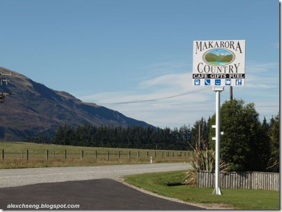
Departing early today, we travelled to the Westland National Park, located in the South Island’s rugged West Coast. We had a quick morning stop at a cafe in Makarora that is filled with a lot of interesting antiques…
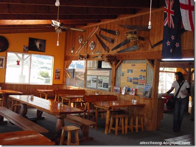


… and you will be shot for stealing!!

Continuing with our journey, we travelled via the Haast Pass passing by glaciel lake and snow-capped mountains. It is one of the three principal road routes that allow access from east to west across the Southern Alps.


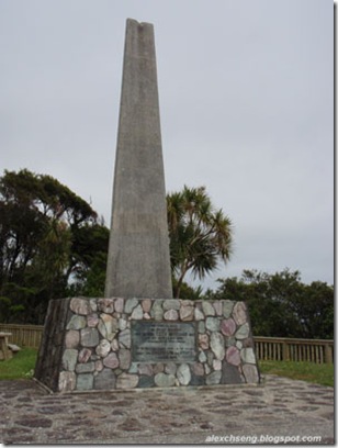
We also had another quick stop at the picturesque Knight’s Point.


Back in the 1950s, a major road project was undertaken to connect South Island’s East Coast, where a team constructed the road from Haast Pass taking it northwards along the coast while another team progressed southwards from the Coast Road at Ross. Both team finally met up at a coastal point, that is now known as Knight’s Point. Since it was a major feat in engineering, an obelisk monument was set up to celebrate the completion of the highway connecting Westland with Otago.
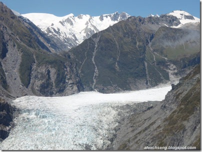
Arriving at the Westland National Park, we stopped at the Fox Glacier township.


Fed by four alpine glaciers, Fox Glacier falls 2,600m on its 13km journey from the Southern Alps down to the coast, with it having the distinction of being one of the few glaciers to end among lush rainforest only 300 metres above sea level (glaciers usually exist from 800 metres above sea level). Although retreating throughout most of the last 100 years, it has been advancing since 1985 at an average of about a metre a week.

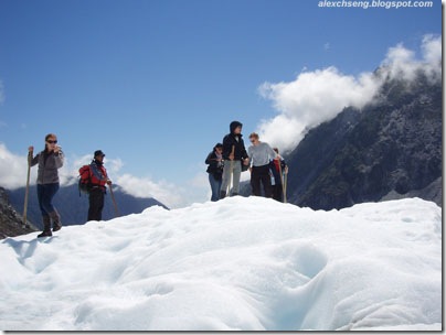
Since we were offered several options to see the glaciers, we opted for the heli-hike, where the excitement of walking on the Fox Glacier is combined with the thrill of helicopter flights. We hopped on the bus with the original 1928 look for a 5 minutes ride to the helipad.

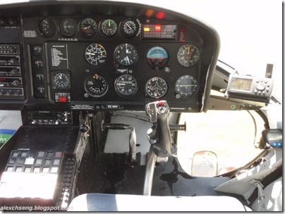
After the safety briefing and equipped with sturdy leather boots, we boarded the helicopter for a 10 minutes flight, before landing at Victoria Flat.

On the way up, we caught breathtaking views of the surroundings in the Westland National Park.


We first flew over the pinnacles of the lower icefall …

… and then circle the upper icefall …


… followed by Victoria Falls …

… before landing on ice in a remote and exceptionally beautiful part of the glacier.


The guide then outfits us with crampons and we had a 2 hour hike following ice steps cut by the guide as we explore the area. It was a hot and sunny day of 20° C in the noon but the surface temperature of the glacier was only 0.2° C.


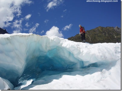
A glacier is a large, slow-moving mass of ice, formed from compacted layers of snow, that slowly deforms and flows in response to gravity and high pressure. When the glacier moves through irregular terrain, cracks form in the fracture zone and they can be up to 50 metres deep.


By flying, it is also the only way we get to explore the spectacular ice caves and arches.


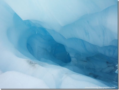


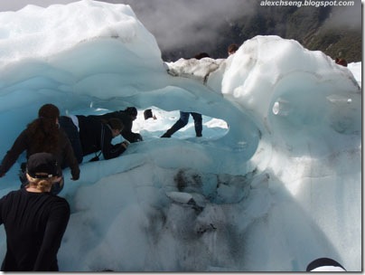
Inside the caves and arches, the ice is blue because the red (long wavelengths) part of white light is absorbed by ice and the blue (short wavelengths) light is transmitted and scattered. The longer the path light travels in ice, the more blue it appears.
Swimming is also one of the options for the brave ones.

During our hike, gusts of wind also brought clouds along, making as though there were people walking on the clouds.


Very soon, 2 hours passed and its time to bid farewell to the glaciers. So, we took a group photo …
 Our heli-hike group
… and then board the helicopter flying back down into town.


Again, we were treated with the spectacular views of the region during our 10 minutes flight down.


We were also given a certificate to certify that we survived both the Fox Glacier as well as the rumblings of the guides.
 Certificate of Survival
Travels today from Queenstown to Fox Glacier was about 350km. Together with the 2 hour hike, everyone pretty much knocked out when we arrived at our accommodation for that night.
No comments:
Post a Comment